Maps
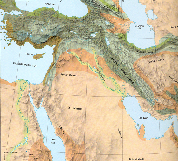
A topographical map of the Near East, courtesy of Brown University.
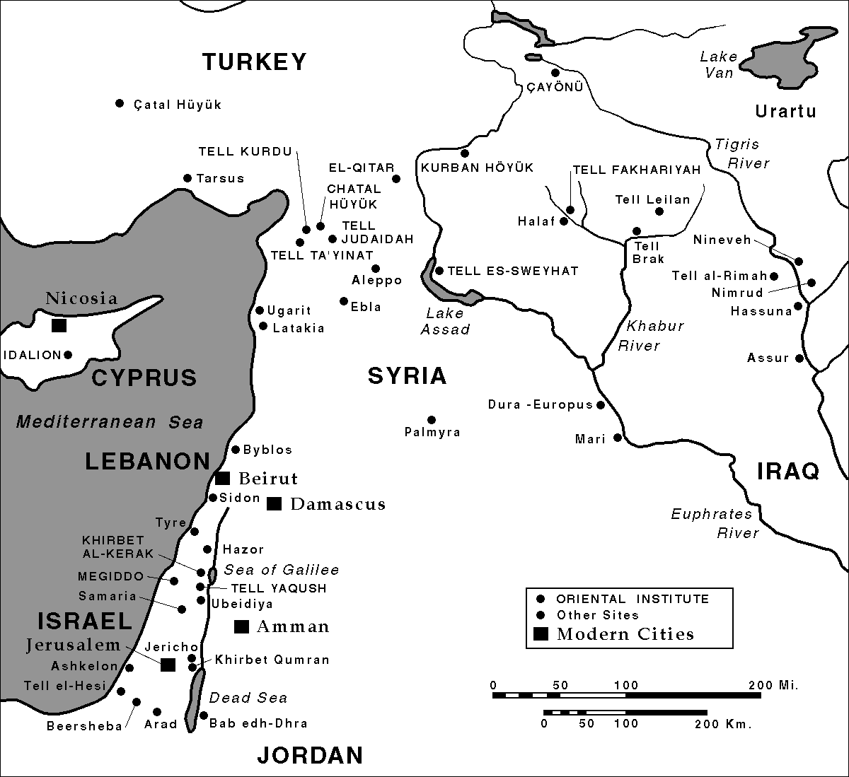
The Oriental Institute Map Series – Iraq Site Map displays the location of archaeological sites in modern day Iraq.
The Oriental Institute Map Series – Syria Site Map displays the location of archaeological sites in modern day Syria.
The Oriental Institute Map Series – Levant Site Map displays the location of archaeological sites in the modern day Levant.
The Assyrians provides interactive maps of both the Assyrian and Neo-Assyrian empires beginning with the Assyrian homeland (1250 BC) and ending with Assyria during the reign of Ashurbanipal (650 BC).
Assyria Empire at the death at the death of Shamshi-Adad c. 1721 BC. Courtesy of Wikipedia.
The Assyrian Empire (c. 1500-627 B.C.). Assyria 1500 B. C., Empire of Tiglath-Pileser I, 1114-1076 B.C., Empire of Shalamaneser III, 858-824 B.C., Empire of Sargon II 721-705 B.C., Empire of Ashurbanipal 668-627 B.C. Courtesy of Alef Maps.
Middle East and Eastern Mediterranean 14th century BC. Courtesy of Wikipedia.
Assyria Expansion Map detailing the expansion of the Neo Assyrian Empire from Bible History Online.
The Assyrian Empire 824-625 B. C. Map – courtesy of www.hammondmap.com from ‘Atlas of the Bible Lands’ – C S Hammond & Co – 1959.
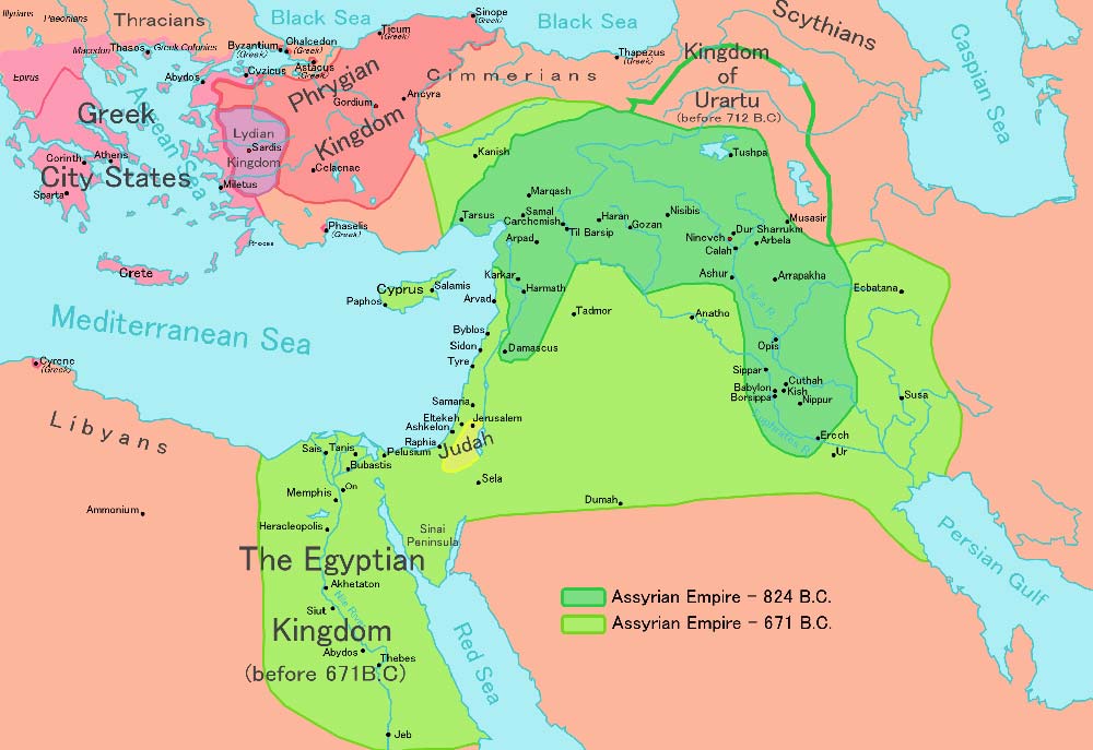
Assyrian Empire about 824-671 BCE. Map of the Assyrian Empire and neighboring kingdoms.
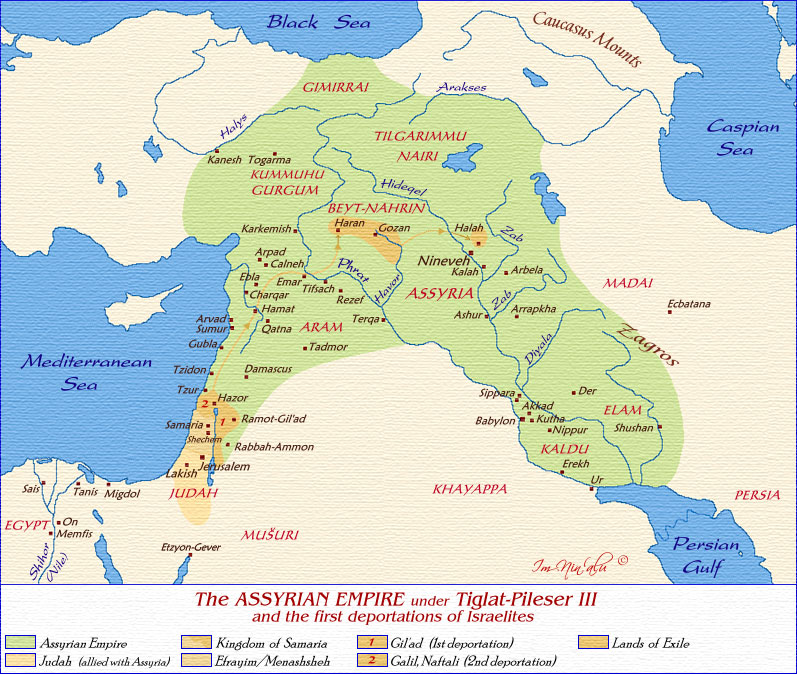
The Assyrian Empire under the reign of Tiglath-Pileser III Courtesy of Im ninalu.net
The Assyrian Empire c. 700 BC. Map of the Assyrian Empire and route taken by Israelite exiles.
The Campaigns of Shalmaneser III
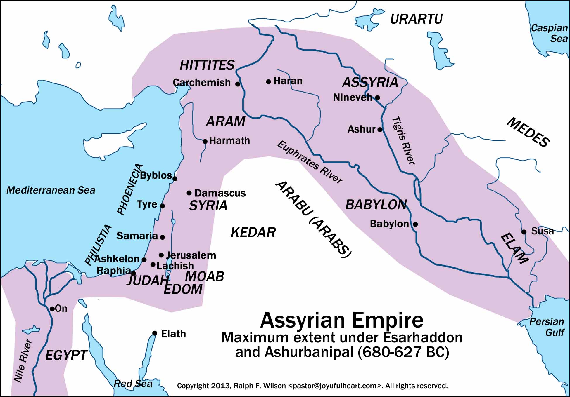
Assyrian Empire Maximum extent under Essarhaddon and Ashurbanipal (680-627 BC.) Map of the Assyrian Empire at greatest extent.
The Ancient Near East Map of the ancient Near East detailing the regions between the Euphrates and the Red Sea from Bible History Online.
Map of Ancient Mesopotamia From Bible History Online.
The Territory of the Philistines Map of the The territory of the Philistines during the time of David and Solomon from Bible History Online.
Map of Ancient Trade Routes From Mesopotamia Map of Ancient Trade Routes From Mesopotamia to Egypt and the Mediterranean Sea.
The Assyrian Empire (c.1500 B.C.-627 B.C.) From Alef.net.
Maps of Historic Assyria Twelve maps and a historic timeline of Mesopotamian States.
The Babylonian and Assyrian Empires From the International History Projec
Deportation of Israelites by Assyria Courtesy of Wikipedia.
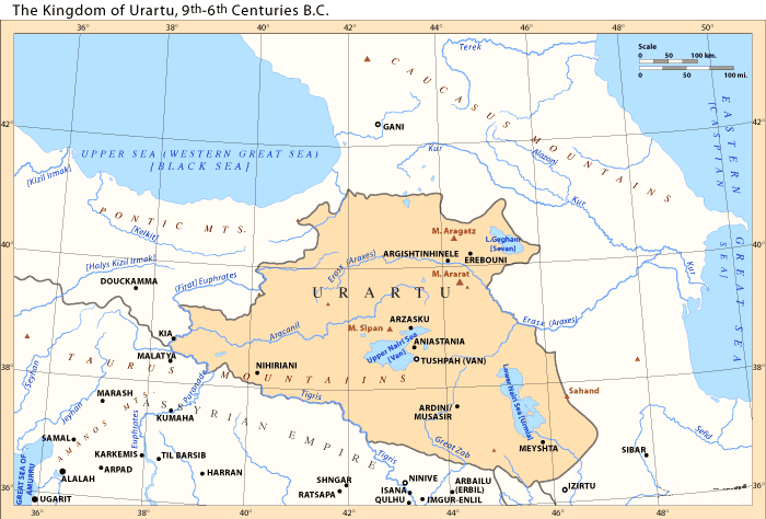
The Kingdom of Urartu 9th-6th centuries B. C. Courtesy of Wikipedia.
Kingdom of Urartu during King Arames c.860-840 BC Courtesy of Wikipedia.
Urartu during King Rusa I, between-715 and-713 Courtesy of Wikipedia.
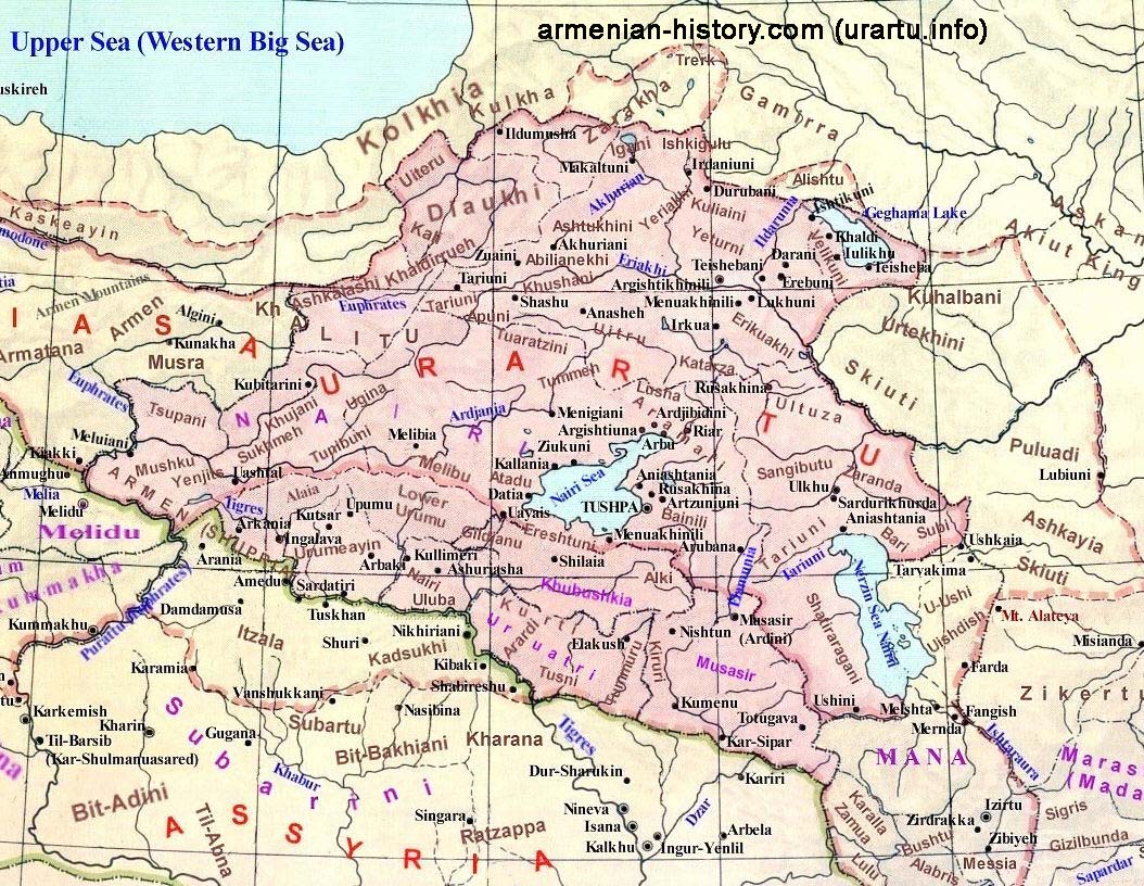
Map of Urartu Courtesy of Armenian-History.com
Map detailing Urartian expansion Courtesy of Mapas Imperiales
Urartian Fortresses Courtesy of Wikipedia
Map of Phrygia Courtesy of Wikipedia.
Map of NeoHittite States Courtesy of Wikipedia.
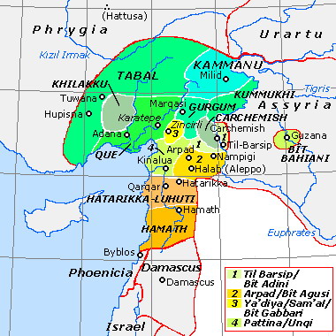
Map of NeoHittite and Aramean States Courtesy of Wikipedia.